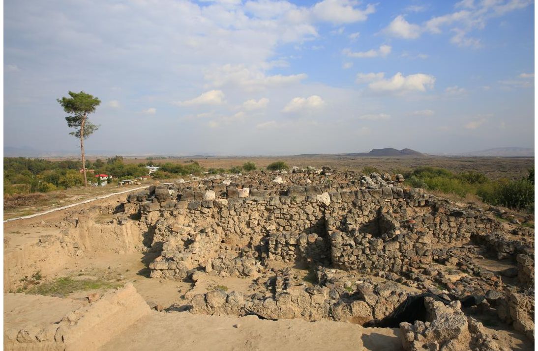
Tatarlı Höyük
Tatarlı Höyük is an important settlement area that will shed light on the past of Çukurova Region. Hills consisting of layers of old settlements in Anatolia are called Höyük (meaning mound in Turkish) among the people. The most important feature sought for a settlement in the past was its safety and ease of access to water. There are many water sources around Tatarlı Höyük, such that even today, most of the drinking water needs of the Ceyhan District are supplied from here.
Tatarlı Höyük is one of the important settlements of the Kizzuwatna Kingdom. The Kizzuwatna Kingdom is a semi-independent state that has always been in good relations with the Hittite State and is respected for its religious nature. Earthen oil lamps used in rituals, relief and appliqué figurines of goddesses belonging to Zeus, among the works found in the excavations, revealed the religious-sacred side of the city.
The height of the mound is 37 meters and its dimensions are 360x250 meters. Considering the city below, it will be seen that the settlement is spread over a very large area of 2.3 square kilometers.
It is thought that the first settlement in Tatarlı Höyük was in the Late Bronze Age and later in the Iron Age. One of the important features of the mound is the wastewater system, which can be described as a very advanced technology for that period.
When the findings obtained during the excavations and the information in the written sources are evaluated together, the possibility of Tatarlı Hüyük being the holy city of Luhuzatia/Lawazantiya, whose location is still unknown today, becomes stronger. The fact that Lawazantiya is mentioned as "the city with 7 springs" in the sources and that there are still used water sources on the foot of the mound strengthens this thesis.
Weaving looms, which were found extensively in Tatarlı Höyük excavations, show that the city was a specialized textile production center in this field.
The intense presence of Cyprus and Rhodes amphorae indicates the intense commercial relationship of the city, which is located on trade routes, with these regions.
One of the most interesting explorations in Tatarlı Höyük are the bones of an Asian elephant. It shows that the Asian elephant once lived in this region.
Where is Tatarli Höyük? Directions Information. How to Get to the Mound?
Tatarlı Höyük is located within the borders of Tatarlı neighborhood in Adana's Ceyhan district. It is 31 km from Ceyhan and 75 km from Adana.
To get to Tatarlı Höyük from Adana, you must proceed in the direction of Osmaniye along the Adana-Osmaniye Highway. You should continue to the east by passing the Ceyhan-Kadirli turn and turn left (north) in Mustafabeyli Town to reach Tatarlı district.
You can use the 506 (Ceyhan-Günlüce) buses departing from Ceyhan to go to Tatarlı Höyük by public transportation.
Tatarlı Höyük is closed to visitors as excavations continue.
In the immediate vicinity of Tatarlı Höyük, there is Kaynargöz spring, which should be seen with its water resources and nature. This place is a nice alternative to cool off, especially with lotus flowers, a small lake and vegetation. There is a restaurant that provides food & beverage services here.
Places to be seen around Tatarlı Höyük:
Anavarza Ancient City: 30 km
Yılankale: 39 km
Misis Bridge: 52 km